



CDOT warns commercial drivers to avoid damaged mountain routes as crews work to restore access to Pagosa Springs and Durango.
SOUTHWEST COLORADO — Truck drivers traveling through southwest Colorado should prepare for lengthy detours and delays because of flood damage to several major highways, including sections of US Highway 160 between Durango, Pagosa Springs and South Fork.
The Colorado Department of Transportation (CDOT) reported Thursday, Nov. 5, that multiple highway closures remain in place following two weeks of severe flooding that washed out roads, damaged bridges and triggered mudslides and rockslides.
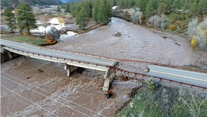
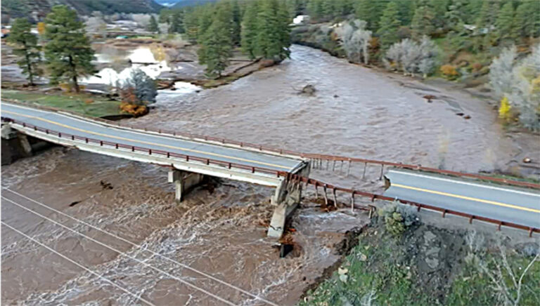
Among the most significant problems is the collapse of support piers at the Piedra River Bridge on US 160, approximately 18 miles west of Pagosa Springs. The bridge must be rebuilt, although CDOT plans to install a temporary structure as soon as conditions allow.
For commercial drivers, the closures mean substantial additional travel time, particularly for deliveries into Pagosa Springs, Bayfield and Durango. CDOT advises long-haul freight carriers traveling east-west through the region to consider alternate interstate routes, including I-70 to the north and I-40 to the south.
Major highway closures remain in place
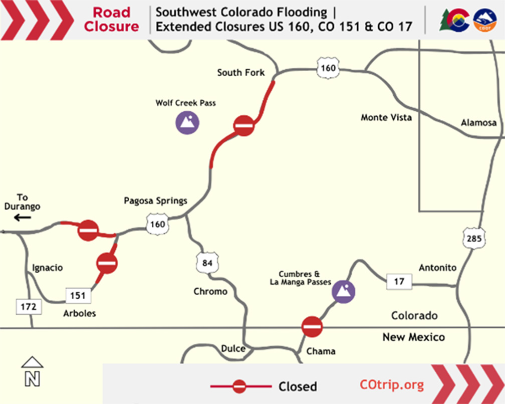
As of Thursday morning, Nov. 5, CDOT reported the following closures and restrictions:
• US 160 between Pagosa Springs and Durango (mile point 121): Multiple sections require emergency repairs. The Piedra River Bridge is impassable following the collapse of its support piers, and crews are preparing for a temporary replacement.
• US 160 over Wolf Creek Pass (MP 157-184.5): The highway remains closed between the Pagosa Springs area and South Fork. Flooding, mudslides and rockslides have damaged several locations along the route. Floodwaters also undermined travel lanes and washed out part of the roadway near The Narrows, approximately six miles west of South Fork.
• CO 151 south of Chimney Rock (MP 27-30): Additional flooding Nov. 1 washed out another section of highway approximately four miles south of the US 160 junction. Emergency reconstruction is underway.
• CO 17 between Antonito and the New Mexico state line (MP 0-39): Access is restricted, with no through traffic allowed. Repairs continue along Cumbres and La Manga passes, and significant damage to NM 17 prevents travel beyond the state line.
CDOT is prioritizing repairs and stabilization along US 84 south of Pagosa Springs to keep that route available. Drivers should expect flaggers or temporary traffic signals at two work zones.
Downtown Pagosa Springs also remains affected by flooding. CDOT advises motorists to avoid the downtown area unless they are residents or emergency personnel.
Detours add hours to travel
CDOT has outlined several regional detours for drivers who must reach affected communities.
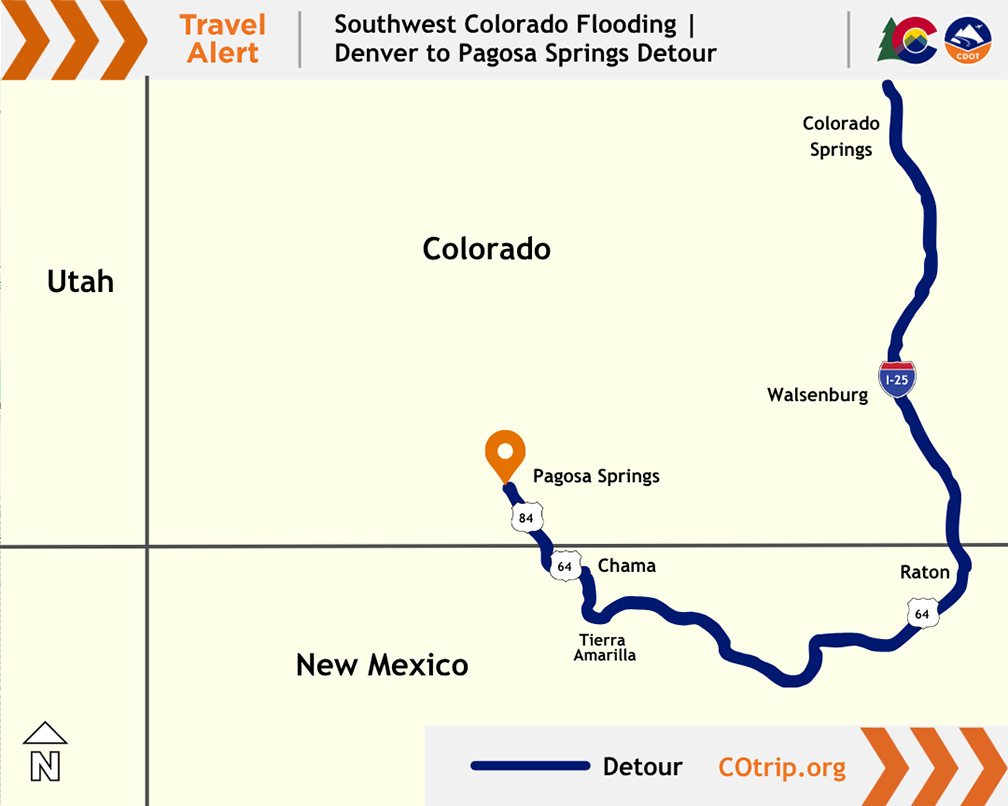
Denver to Pagosa Springs — just over eight hours:
Travel south on I-25 into New Mexico, then take US 64 west at Raton toward Tierra Amarilla. From there, follow US 84/64 north through Chama and into Colorado to reach Pagosa Springs.
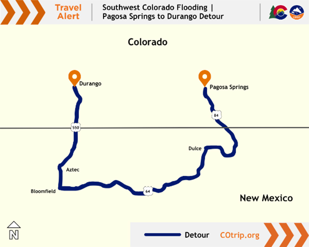
Pagosa Springs to Durango — approximately 2.5 hours:
Take US 84 south into New Mexico, then US 64 west through Dulce to Bloomfield. From Bloomfield, take US 550 north through Aztec and continue into Colorado to Durango.
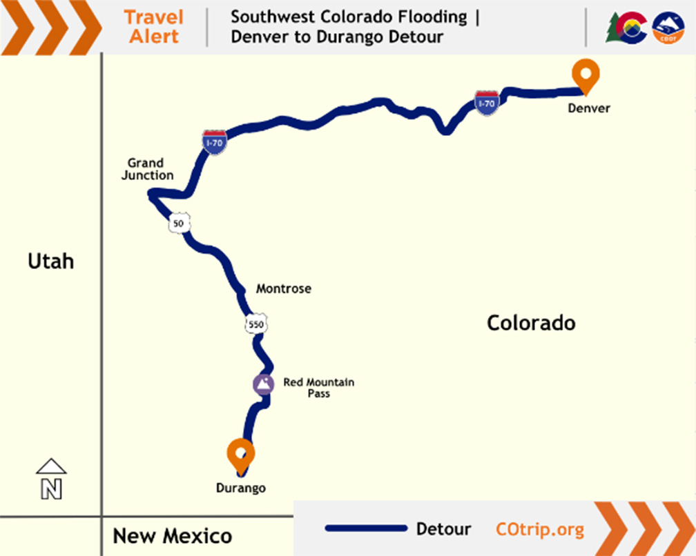
Denver to Durango — just over eight hours:
Take I-70 west to Grand Junction, US 50 south toward Montrose and US 550 south to Durango. CDOT also suggests that freight drivers consider a more westerly alternative using CO 145 through the Telluride area, subject to vehicle restrictions and current road conditions.
These are CDOT’s estimated travel times. Actual travel times may vary depending on traffic, road conditions and vehicle type.
Commercial drivers urged to avoid shortcuts
CDOT warns truck drivers not to rely on GPS shortcuts around highway closures, particularly those involving unpaved county roads, seasonal forest roads or other rural routes. Some roads may have weight restrictions, inadequate turning space for large trucks or additional damage from flooding.
Carriers making essential deliveries should use state-designated routes, verify that detours can accommodate their equipment and allow extra time for travel. Truck drivers should also watch for flaggers, temporary signals and reduced speed limits near repair sites.
Crews continue to remove debris, stabilize damaged roadways and prepare for longer-term reconstruction. Some repairs may take considerable time, particularly where bridges or entire sections of highway must be rebuilt.
Check conditions before traveling
Because closures and restrictions can change as repairs progress, CDOT advises drivers to check current conditions before entering southwest Colorado.
Real-time highway information is available at COtrip.org or through the free COtrip Planner mobile app.
Drivers traveling through neighboring states can check conditions at NMroads.com, AZ511.gov and UDOT Traffic.
CDOT cautions that its travel information does not include all local city, county or forest road closures. Drivers should contact local road authorities when planning routes off the state highway system.

Linda Garner-Bunch has been with The Trucker since 2020, picking up the reins as managing editor in 2022. Linda has nearly 40 years of experience in the publishing industry, covering topics from the trucking and automotive industry to employment, real estate, home decor, crafts, cooking, weddings, high school sports — you name it, she’s written about it. She is also an experienced photographer, designer and copy editor who has a heartfelt love for the trucking industry, from the driver’s seat to the C-suite.