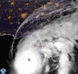
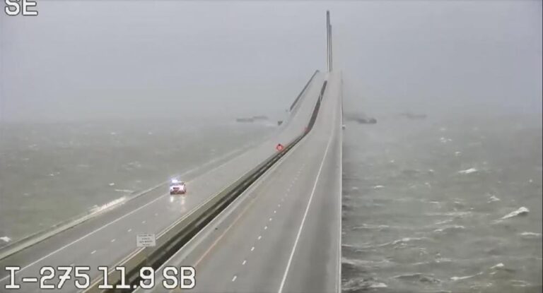
ST. PETERSBURG, Fla. — Hurricane Ian rapidly intensified as it neared landfall along Florida’s southwest coast Wednesday morning, gaining top winds of 155 mph, just shy of the most dangerous Category 5 status. Damaging winds and rain lashed the state, and the heavily populated Naples to Sarasota region was at highest risk of a devastating storm surge.
Florida has suspended tolls on certain roadways, and the state has also waived hours of service requirements for big rig drivers as a result of the storm.
U.S. Air Force hurricane hunters confirmed Ian gained strength over warm Gulf of Mexico water after battering Cuba, bringing down the country’s electricity grid and leaving the entire island without power. Ian was centered about 65 miles west-southwest of Naples at 7 a.m., swirling toward the coast at 10 mph.
“This is going to be a nasty nasty day, two days,” Florida Gov. Ron DeSantis said early Wednesday, stressing that people in Ian’s path along the coast should rush to the safest possible shelter and stay there.
The massive storm appeared on track to slam ashore somewhere north of Fort Myers and some 125 miles south of Tampa, sparing the bay area from a rare direct hit from a hurricane. The area is popular with retirees and tourists drawn to pristine white sandy beaches and long barrier islands, which forecasters said could be completely inundated.
Catastrophic storm surges could push as much as 12 feet to 16 feet of water over coastal areas straddling Punta Gorda and Fort Myers, which are between Naples and Sarasota, the hurricane center warned. Rainfall near the area of landfall could top 18 inches.
“If you are in any of those counties it is no longer possible to safely evacuate. It’s time to hunker down and prepare for the storm,” DeSantis said. “Do what you need to do to stay safe. If you are where that storm is approaching, you’re already in hazardous conditions. It’s going to get a lot worse very quickly. So please hunker down.”
More than 2.5 million people were under mandatory evacuation orders, but by law no one could be forced to flee. The governor said the state has 30,000 linemen, urban search and rescue teams and 7,000 National Guard troops from Florida and elsewhere ready to help once the weather clears.
“The assets we have are unprecedented in the state’s history and, unfortunately, they’ll need to be deployed,” DeSantis said.
Florida residents rushed ahead of the impact to board up their homes, stash precious belongings on upper floors and join long lines of cars leaving the shore.
“You can’t do anything about natural disasters,” said Vinod Nair, who drove inland from the Tampa area Tuesday with his wife, son, dog and two kittens, seeking a hotel in Orlando, where only tropical-storm force winds were expected. “We live in a high risk zone, so we thought it best to evacuate.”
Winds exceeding tropical-storm strength of 39 mph reached Florida by 3 a.m. and the first hurricane-force winds were recorded by 6 a.m., well in advance of the eyewall moving inland, the Miami-based center said.

Overnight, Hurricane Ian went through a natural cycle when it lost its old eye and formed a new eye. The timing was bad for the Florida coast, because the storm got stronger and larger only hours before landfall. Ian went from 120 mph to 155 mph in just three hours, the second round of rapid intensification in the storm’s life cycle.
“With the higher intensity you’re going to see more extensive wind damage. The larger wind field means that more people will experience those storm-force winds,” University of Miami hurricane researcher Brian McNoldy said. And “it will really increase the amount of storm surge.”
Ian’s forward movement shifted slightly southward, likely sparing Tampa and St. Petersburg their first direct hit by a major hurricane since 1921.
Instead, the most damaging winds could hit a rapidly developing coastline where the population has jumped sevenfold since 1970, according to the U.S. Census, which shows Lee County has seen the eighth largest population growth among more than 180 Atlantic and Gulf coast counties in the past 50 years.
There were 250,000 people in the Fort Myers/Lee County mandatory evacuation zones, and authorities worried ahead of the storm that only 10% or so would leave.
Gil Gonzalez wasn’t taking any chances. He boarded the windows of his Tampa home with plywood, laid down sandbags, and with his wife, packed their car with bottled water, flashlights, battery packs for their cellphones and a camp stove before evacuating. “All the prized possessions, we’ve put them upstairs in a friend’s house,” Gonzalez said.
Airports in Tampa, St. Petersburg and Key West closed, as did Disney World theme parks and Sea World in Orlando ahead of the storm.
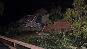
The precise location of landfall was still uncertain, but with Ian’s tropical storm-force winds extending 175 miles from its center, flash floods were possible across the whole state. Parts of Florida’s east coast faced a storm surge threat as well, and isolated tornadoes were spinning off the storm well ahead of landfall. One tornado damaged small planes and a hangar at the North Perry Airport, west of Hollywood along the Atlantic coast.
Florida Power and Light warned those in Ian’s path to brace for days without electricity. As a precaution, hundreds of residents were being evacuated from several nursing homes in the Tampa area, where hospitals also were moving some patients.
Parts of Georgia and South Carolina also could see flooding rains and some coastal surge into Saturday. Georgia Gov. Brian Kemp preemptively declared an emergency, ordering 500 National Guard troops onto standby to respond as needed.
The Trucker News Staff contributed to this report.
The Associated Press is an independent global news organization dedicated to factual reporting. Founded in 1846, AP today remains the most trusted source of fast, accurate, unbiased news in all formats and the essential provider of the technology and services vital to the news business. The Trucker Media Group is subscriber of The Associated Press has been granted the license to use this content on TheTrucker.com and The Trucker newspaper in accordance with its Content License Agreement with The Associated Press.


